MWVCOG's Geographic Information Systems (GIS) staff are experts in the use of spatial data analysis, advanced data tools and skilled methods to provide answers to vital questions, using the latest GIS development tools and database technology. Staff can also provide clients with professional custom maps, web applications, data extracts, analytical models, and spatial analysis.
Staff works regularly with the Salem-Keizer School District, Yamhill County and member cities developing GIS Centric Web Applications and assisting with their planning, communications, and transportation needs.
We help members with GIS technology with the delivery and planning of government or non profit services.
- Yamhill County Butterfly Protection GIS Mobile Application.
- Yamhill County GIS Application
- Salem-Keizer School Finder Mapping Application
- Salem-Keizer Schools boundary maps
- GIS training for the Salem-Keizer School District
- Salem-Keizer Transit route maps
- SKATS maps
- Buildable Land Inventories for cities in Marion and Polk County
- Comprehensive Plan and Zoning Maps for member cities
- Coordination of the Willamette Valley GIS User Group
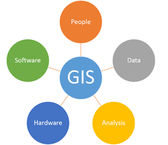
A geographic information system (GIS) is a system that creates, manages, analyzes, and maps all types of data. GIS connects data to a map, integrating location data (where things are) with all types of descriptive information (what things are like there). This provides a foundation for mapping and analysis that is used in science and almost every industry. GIS helps users understand patterns, relationships, and geographic context. The benefits include improved communication and efficiency as well as better management and decision making.